
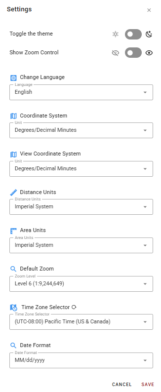
The Settings Panel can be opened by selecting the user initials avatar from the Top Right Toolbar. It provides user-level configuration options that control the look, feel, and localization of the interface.
-
Toggle the theme: A toggle switch to switch between light and dark mode. Icons on either side indicate the sun (light) and moon (dark) states.
-
Show Zoom Control: A toggle switch to show or hide the zoom control widget on the map canvas. The number in the center indicates the current zoom level.

-
Change Language: A dropdown to set the interface language (English, Spanish, or French).
-
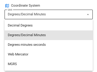
Coordinate System: A dropdown to set the coordinate system used when entering coordinates.
-
View Coordinate System: A separate dropdown controlling the coordinate format used when viewing coordinates on the map. The options are the same as for Coordinate System above.
-
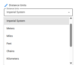
Distance Units: A dropdown to set the unit system for distance measurements. Defaults to Imperial System.
-
Area Units: A dropdown to set the unit system for area measurements.
-
Default Zoom: A dropdown to set the map's default zoom level on load. Defaults to Level 6 (1:9,244,649) with 23 possible levels.
-
Time Zone Selector: A dropdown to set the user's time zone for date and time display. Click the refresh icon to reset to default.
-
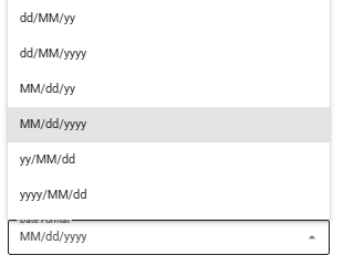
Date Format: A dropdown to set the preferred date display format. Defaults to MM/dd/yyyy.
A Cancel button discards any changes and closes the panel. A Save button commits all changes.