
The Feature Manager lists all geometry features associated with the selected record. Each feature row has two action icons: a location pin icon to zoom the map to that specific feature, and a delete (trash) icon to remove it.

Feature Manager Toolbar
A toolbar in the top right of the Feature Manager provides additional geometry management actions. These options will vary depending on the type of feature (Plan, Project, etc.) selected.

Warning Icon
Specifies the type of geographic features (e.g., point and polygon) accepted for the current feature type.
Clip & Save
Clips the geometry to the parent geometry. For example, clip a Treatment geometry to a Project geometry.
Delete
Removes selected features. A confirmation window appears.

Export
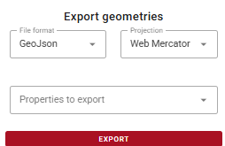
Exports selected geometries to GeoJson, KML, or SHP formats with the option for Web Mercator or Geographic projection. Use the Properties to export button to select the attributes to include in the exported file.
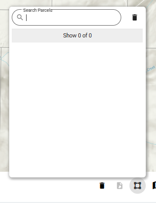
Parcels
Search parcels with a free-text search field.
Add or edit features
Adds a widget with options to Add Features, Edit Features, or Close.
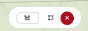
The Add features option allows the user to select a symbology from the dropdown and draw a free hand polygon.

Edit Menu Options
The Edit features option allows the user to edit the selected record. The menu will be grayed out if no features are selected.

-
Modify: Modifies the shape of an existing feature by moving, adding, or deleting vertices.
-
Resize: Maintains the shape of an existing feature but resizes it.
-
Split by Line: Splits a single feature into two separate features along a drawn line.
-
Split Aggregate: Expands or extracts a portion of a polygon depending on
where the line is drawn. -
Aggregate: Expands an existing polygon by drawing a line that starts and ends within its boundary, merging the new enclosed area into the shape.
-
Merge Polygons: Combines multiple selected polygon features into one.
-
Difference Polygons: Subtracts one polygon from another.
-
Intersect (Overlap): Isolates the shared area between polygons.
-
Intersect (No Overlap): Retains all polygons while eliminating their overlapping portions.
-
Remove : Deletes the selected feature.
-
Undo: Undoes the last geometry action.
-
Redo: Redoes a previously undone action.
-
Close (✕): Exits editing mode and returns to the standard map view.
Upload Geometries
Uploads geometry from an external file (zipped SHP, KMZ/KML, or GeoJSON). A file selector window appears.
Headers
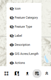
Adjusts which attributes are visible in the table
Expand/Collapse
Toggles the Feature Manager panel height.