
To open Map Controls, tap the Map Controls (three dots) icon on the main Map interface or on the Map tab of an Incident Card. The available controls depend on where you open them.
The available controls depend on where you open them (from the main Map or from an Incident Card).
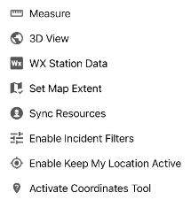
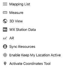
Mapping Features List
The Mapping Features List displays the mapping features for the selected incident, grouped by feature type. Use it to find, import, and export features.
Only available when accessing the Map Controls from an Incident Card.
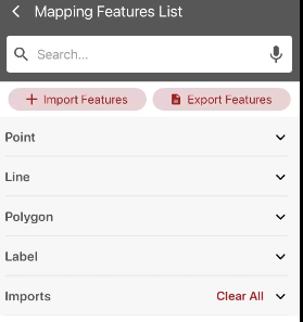
Search
Enter a feature name in the Search bar to filter the list. Tap the microphone icon to search by voice.
Import and Export Features
-
Import Features: Import features from a file on your device. Supported formats: KML or KMZ files.
Imported map features cannot be synced through Main App Sync or My Edits.
-
Export Features: Export the incident’s features to a file. Output format: KMZ or GeoJSON.
Feature Types
Features are grouped into the following categories. Tap a category to expand or collapse it.
-
Point
-
Line
-
Polygon
-
Label
-
Imports: Features added using Import Features. Tap Clear All to remove all imported features.
Tap the eye icon next to a feature to toggle visibility on/off. Tap the arrow to see more information about the feature.
Feature Details
Tap the document icon in the top-right corner to download the feature.
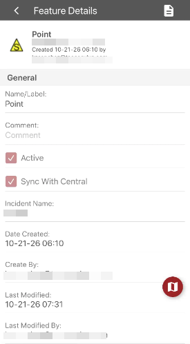
The header displays the feature type symbol, name, coordinates, creation date, and the user who created it.
General
-
Name/Label: The feature name displayed in the list.
-
Comment: Optional notes about the feature.
-
Active: Select to display the feature on the map. Clear to hide it.
-
Sync With Central: Select to share the feature with other users on the incident. Clear to keep it on your device only.
-
Incident Name: The incident the feature belongs to.
-
Date Created and Created By: When and by whom the feature was created.
-
Last Modified and Last Modified By: When and by whom the feature was last edited.
Screen Controls
-
Back arrow: Return to the Mapping Features List.
-
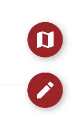
Map icon: Zoom to the feature on the map.
-
Pencil icon: If a feature is editable, a pencil icon appears below the map icon. Tap to edit the feature.
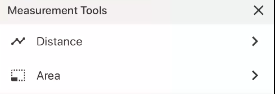
Measure
Measure length, area, or perimeter on the map. Select Distance for length or Area for area or perimeter, then tap the map to add vertices.
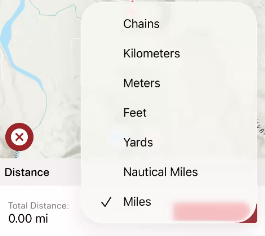
To change units, tap the red dropdown.
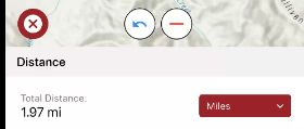
Tap the red minus to erase a vertex or the blue arrow to undo. Tap the red x when you are finished.
3D View
Displays the map in three dimensions, showing terrain elevation.
WX Station Data
Tap a weather (WX) station on the map to view its data.
The WX Station Data tool does not stay active. Users will need to re-activate this tool each time they wish to use it.
AR
Opens an augmented reality (AR) view that overlays incident, resource, and map data on your device camera view. Requires camera permissions: tap Accept to enable.
Tap the Settings button and use the slider to adjust basemap opacity if needed.
Tap Layers, then select the checkboxes to turn layers on or off.
Only available when accessing the Map Controls from an Incident Card.
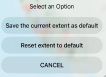
Set Map Extent
Choose Save the current map view as your default map extent or Reset the extent to default.
Sync Resources
Manually refreshes resource data from the server.
Enable Incident Filters
On/off toggle. Applies the configured incident filters. An orange dot appears to indicate filters have been applied. Tap again to disable incident filters.
Only available when accessing the Map Controls from the main Map interface.
Enable Keep My Location Active
Allows TA Mobile to actively track your location. Requires location permissions to be enabled on your device.
Keeping your location active increases battery consumption. This feature is disabled by default.
Activate Coordinates Tool
Tap a point on the map to retrieve its coordinates.
The coordinates tool does not stay active. Users will need to re-activate this tool each time they wish to use it.