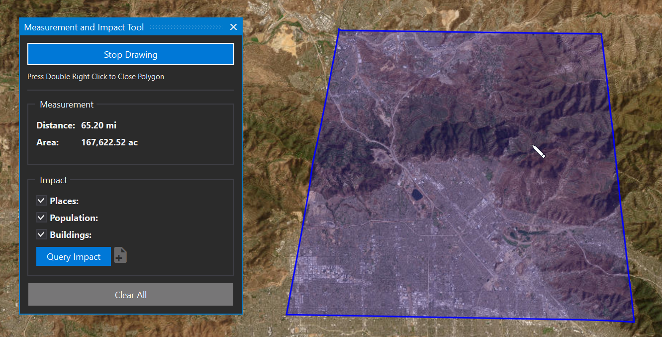
The measurement and impact tool allows you to measure distance in miles and area in acres and calculate the population and buildings within the area.
Draw Measurement
To measure and calculate impacts:
-
Single click on the map to start measuring and continue clicking to draw a shape.
-
Right click to remove the last point.
-
-
Double right click to close the polygon.
Calculate Impacts
After drawing your area, click the Query Impact tool to see population and building estimates for that location.
Use the Export to KMZ button to export the impact points to a KMZ file for use with Google Earth.