About FPIC
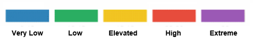
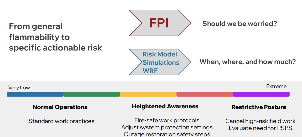
FPIC is Technosylva’s primary metric for assessing fire potential and provides a discrete rating from one to five (very low to extreme):
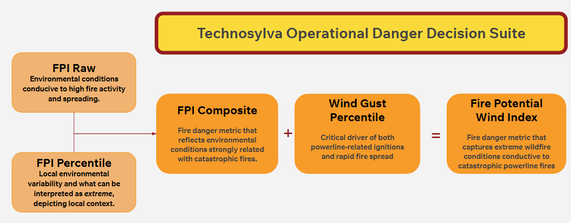
FPIC combines two key components:
-
FPI Raw (FPIR): Predicts fire activity and rate of spread based on weather and fuel moisture. FPIR reflects environmental conditions that favor high fire activity and rapid spread.
FPI Raw measures can be interpreted as follows:
-
Very Low: Vegetation and weather conditions are moist and not conducive to ignition or fire spread. Fire starts are unlikely, and spread potential is minimal.
-
Low: Vegetation and weather conditions are relatively moist. Ignition and fire spread are possible but unlikely, and fires are expected to remain small.
-
Moderate: Vegetation and weather conditions are marginally conducive to ignition and fire spread. Fire activity is possible, primarily where fuels, terrain, and weather align. Large fires are unlikely.
-
High: Vegetation and weather conditions are conducive to ignition and fire spread. Conditions are consistent with typical fire-season environments. Most fires remain small, but large fires are possible when fuels, terrain, and weather align.
-
Very High: Vegetation and weather conditions are highly conducive to ignition and fire spread. Conditions are consistent with peak fire-season environments. Large fires are possible and more likely when fuels, terrain, and weather align.
-
Extreme: Vegetation and weather conditions are exceptionally conducive to ignition and rapid fire spread. These conditions are historically associated with large, fast-moving fires when fuels, terrain, and weather align.
-
FPI Percentile (FPIP): Indicates where the current FPIR value falls within historical records, highlighting how rare or extreme current conditions are in the local context.
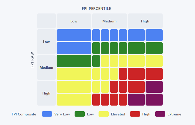
FPIC is derived by identifying the intersection of high danger conditions and low-frequency events that lead to extreme fire potential. The breakpoints for the FPIC categories were empirically derived from the analysis of historical fire data to ensure each level corresponds to meaningfully different fire behavior characteristics.
For a table showing the exact values from which FPIC is derived, please contact your Customer Success representative or reach out to our Customer Success Team.
By integrating both current fire danger and local historical context, FPIC identifies not only high-risk conditions but also rare, extreme events. Unlike many competing indices, FPIC incorporates decades of climatological data and uses percentiles in its formulation, meaning better calibration even for areas where historical fire activity is scarce.
Operational Use
FPIC enables utilities to quickly quantify short-term fire activity potential across their territory, supporting informed operational decisions to reduce wildfire threats and risks. Through standard operating procedures, FPIC guides suppression and mitigation strategies.
FPIC is fully integrated into Technosylva’s Wildfire Operations products.
For a more detailed tutorial on using FPIC, see Putting the Fire Potential Index Composite (FPIC) to Use.
FPIC Validation
Technosylva conducts in-depth validation procedures on FPIC. For information on validation procedures and results, please contact your Customer Success representative or reach out to our Customer Success Team.