The Shapefiles tab is where you upload and manage shapefile regions for use in queries. Shapefiles are organized by dataset. Each dataset in your account has its own section with an Add Shapefile option.
Upload a shapefile here before trying to select it in the New Request form. Once uploaded, it will appear as an option under Spatial Selection when that dataset is chosen.
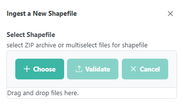
Uploading a shapefile: Click Add Shapefile under the relevant dataset to open the Ingest a New Shapefile dialog. You can upload either a ZIP archive or multiple individual shapefile component files. Click Choose to browse for files, or drag and drop them into the upload area. Click Validate to check the files before ingesting, or Cancel to close without uploading.
Use the Deselect button to clear the current map preview.