Location permission on the mobile device must be set to “Always” to enable Background GPS data collection for mapping.
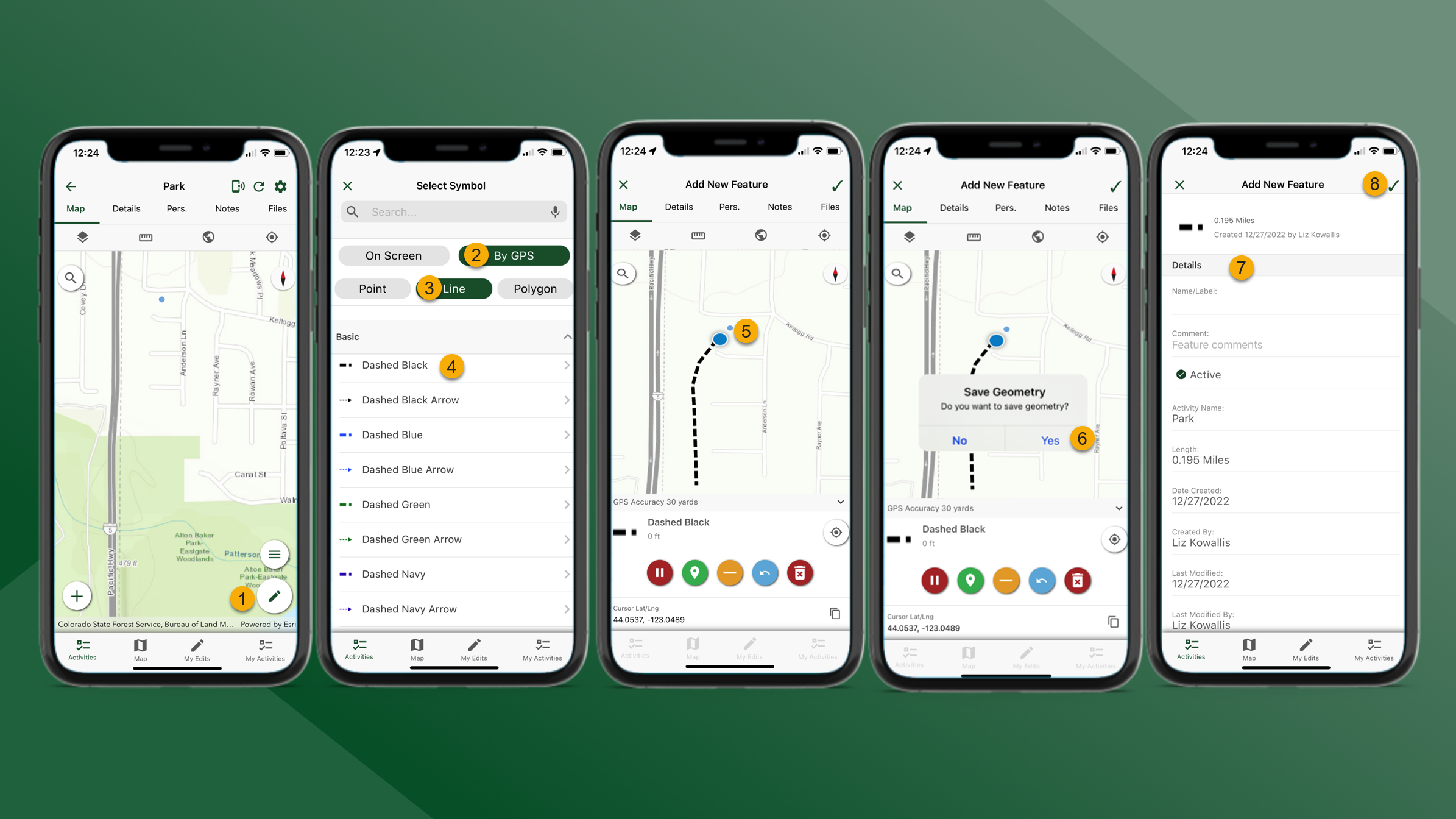
To create map features by GPS, follow the steps outlined below:
-
From the Map tab for the selected Activity tap
at the bottom of the screen.
-
Select By GPS
-
Select feature type
-
Select feature symbol
-
The map will zoom to the user’s location. Begin walking to collect GPS data. Use the Mapping Tools buttons collect the preferred data.
-
Mapping Tools – By GPS
-
Tap
to pause
-
Tap
to add a vertex
-
Tap
to remove a vertex
-
Tap
to undo
-
Tap
to discard the feature
-
-
-
When finished tap
in the top right corner of the screen and then tap Yes.
-
Update the Details as necessary.
-
Tap