
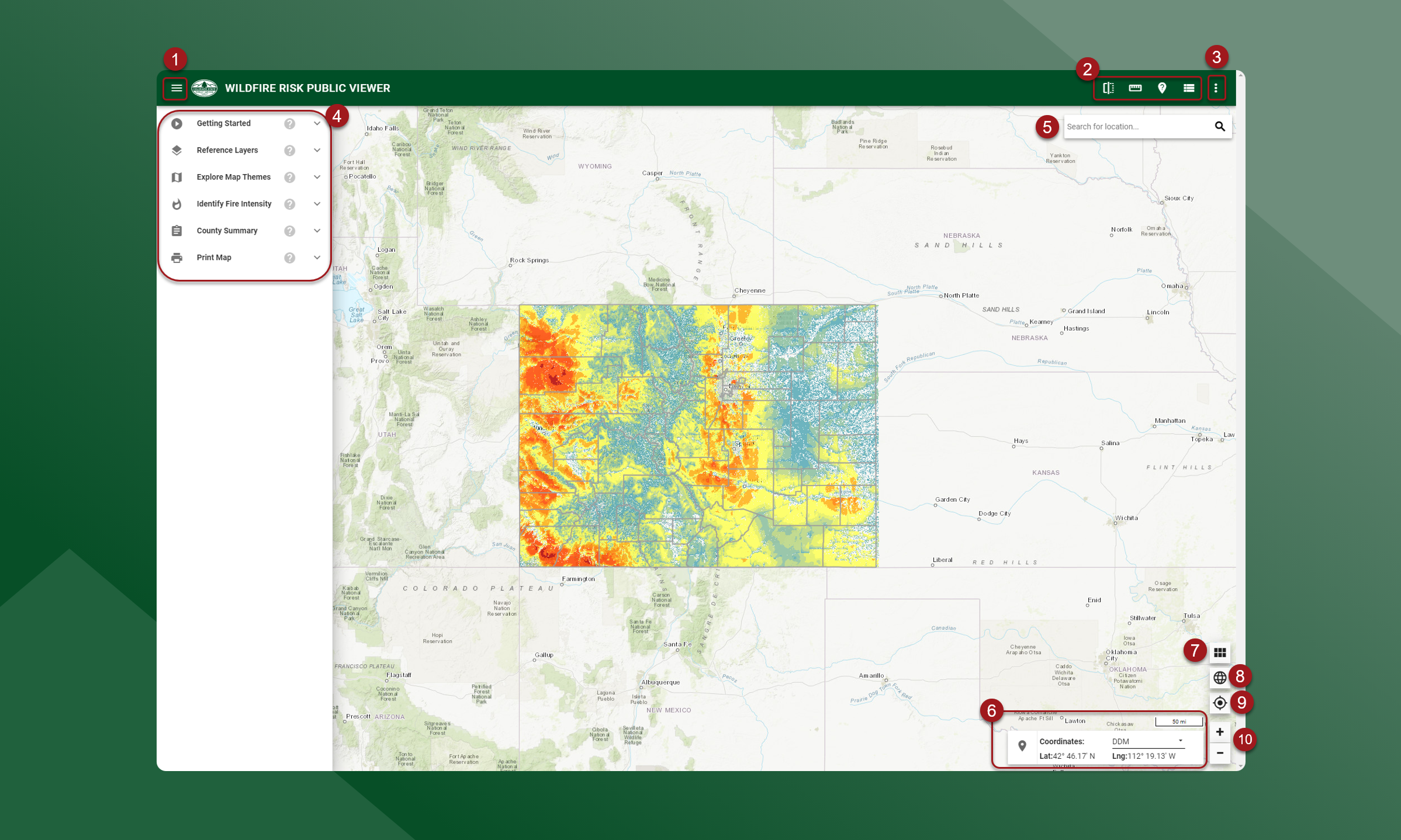
The interface is similar for all the applications, however, these examples will use the Wildfire Risk Public Viewer.
-
3 line menu - Show and hide the left side panel
-
Map tools - swipe, measure, identify, layer legend
-
Menu - links to the Colorado Forest Atlas Home page, Support, and Contact
-
Toolboxes - available toolboxes for the Wildfire Risk Viewer
-
Search bar - navigate to a specific location
-
Navigation tools - navigate the map
-
Basemap - view different basemaps with wildfire risk layers
-
Global Extent - zoom out to view the entire state
-
Current Location - zoom to your current location
-
Zoom in/Zoom out - zoom in or out to fixed extents